
Forsyth County ZIP Coverage
Three Cumming ZIPs form the county's core, while several postal areas touch the edges. The areas below are search clues, not legal polygons. ZIP boundaries follow mail delivery needs and cross county lines. Verify a particular address through the USPS address lookup, then use Forsyth parcel or election geography to confirm jurisdiction.
| ZIP | Forsyth areas served | Postal city | Boundary note |
|---|---|---|---|
| 30028 | Coal Mountain, Matt, Silver City, Settingdown corridor | Cumming | North and northwest core |
| 30040 | Downtown, Sawnee, Midway, Vickery and Polo | Cumming | City and unincorporated areas |
| 30041 | Lake Lanier side, Sharon Springs, south and east Forsyth | Cumming | Broad unincorporated use |
| 30004 | Extreme southwest fringe | Alpharetta | Crosses Fulton, Cherokee, and Forsyth |
| 30005 | South Forsyth and Johns Creek edge | Alpharetta | Forsyth election maps show county use |
| 30024 | Old Atlanta, Nichols, and Suwanee edge | Suwanee | Split across Forsyth and Gwinnett area |
| 30097 | Far southeast fringe | Duluth | Multi-county ZIP |
| 30107 | West and northwest fringe | Ball Ground | Crosses Cherokee and Forsyth |
| 30506 | Lake Lanier and northeast fringe | Gainesville | Crosses Hall and Forsyth |
| 30534 | North edge | Dawsonville | Possible fringe; verify each parcel |
The list avoids claiming that every address in a fringe ZIP is in Forsyth County. It also avoids treating the mailing city as municipal government. Cumming is the county's sole incorporated city, yet its postal name reaches far into unincorporated county land.
Forsyth County's Three ZIP Cores
The official Georgia regional map identifies 30028, 30040, and 30041 as the core Cumming ZIP areas. Within Forsyth County, each gives a useful first cut. The northern 30028 area includes older communities such as Coal Mountain, Matt, and Silver City. The west and center of 30040 span downtown Cumming, Sawnee, Midway, Vickery, and Polo. The east and southeast 30041 area follows Lake Lanier and South Forsyth communities, including Sharon Springs.
These community terms matter because a deed, obituary, school item, church history, or news report may use a crossroads name instead of the ZIP. Try both. Ga. 400 and rapid subdivision growth changed how places are described, but an older community name can still connect an index entry to the right side of the county.
An official Georgia ZIP map can establish the regional frame. It cannot prove county lines for one lot. The county's parcel and election systems supply that second check.
Forsyth County Postal City Mismatch
“Cumming” is both a city and a much broader mailing label. Many Cumming addresses lie beyond the city limits and receive county services. The reverse mismatch appears along Forsyth County's southern and eastern edges, where county addresses may use Alpharetta, Suwanee, or Duluth. Ball Ground, Dawsonville, and Gainesville labels can appear near other fringes.
Official polling-place geography makes the point visible. Forsyth election locations include Cumming addresses in the three core ZIPs as well as Suwanee 30024 and Alpharetta 30005 addresses inside county election geography. A Forsyth County ZIP code directory must therefore ask two questions: where does USPS deliver the mail, and which government keeps the record?
Search Forsyth County by ZIP
No inspected county portal provides a simple, complete list of people by ZIP. The basic Forsyth QPublic page searches an owner name, a location address, a parcel number, or legal information. It has no separate ZIP-wide field. My Voter Page checks one voter's own status with identity inputs, while the public voter-list order form filters by county, municipality, district, and precinct rather than ZIP. ZIP work is therefore a narrowing process, not one click.
- Enter the full known address in USPS Address Lookup and save the standardized postal city, ZIP, and ZIP+4.
- Open Forsyth QPublic and search the physical location address or parcel number.
- Use Forsyth GIS and Mapping to confirm the parcel, county position, districts, and any available ZIP layer.
- Search the correct custodian by its supported key, such as owner, street, parcel, precinct, or recorded party name.
- When the work becomes street-specific, follow the Forsyth County street directory method rather than treating the entire ZIP as one neighborhood.
A delivered public voter address file could be sorted by ZIP for lawful personal or civic research, but the inspected order form does not create a ZIP filter. Georgia law makes commercial use of an elector list a misdemeanor. Never use a postal grouping to target, stalk, or harass a person.
Forsyth County ZIP Search Fields
The useful portal fields are address based. This table shows what the inspected systems accept and what each result can establish. It also shows why a broad ZIP query must be broken into smaller tasks.
| System | Input field | Required detail | What it confirms |
|---|---|---|---|
| USPS Address Lookup | Street address, city and state | Deliverable address | Preferred city, ZIP, and ZIP+4 |
| Forsyth QPublic | Location Address | Address or numeric street range | Parcel, physical address, owner roll |
| Forsyth QPublic | Parcel Number | Exact displayed ID | Parcel card and map link |
| Forsyth QPublic | Legal Information | Subdivision, lot, or keyword | Indexed legal-description match |
| My Voter Page | Initial, surname, county, birth date | Voter's own identity inputs | Status, polling place, and districts |
| Voter list order | County, municipality, district, precinct | Order form and payment | Electronic public list, not ZIP-filtered |
QPublic's location address is the physical or situs address. The owner mailing address is where the tax notice goes and may carry a different ZIP. Neither field alone proves that the owner lives on the parcel. Compare the deed, homestead indicator, and another suitable record before linking a person to a home.
The USPS lookup shown below is the proper first check for mailing geography.
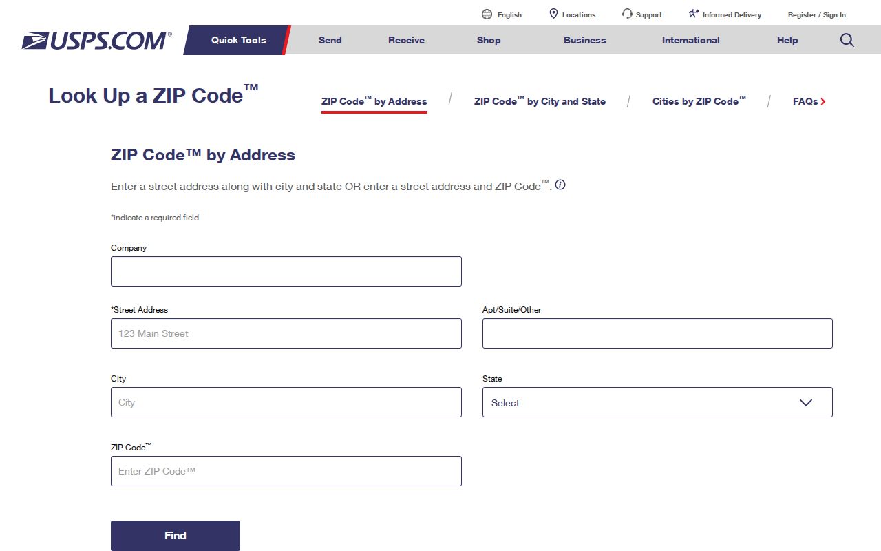
Carry its standardized result into the county systems instead of guessing from a neighborhood label.
Forsyth County ZIP Terms
Postal and land systems describe different things. A search becomes more accurate when each term stays in its own lane. The county's fast growth makes this especially important because new streets and subdivisions do not erase older parcel and legal-description links.
- ZIP code
- A USPS mail-delivery area. It is not a city, county, election, or school boundary.
- ZIP+4
- The basic five digits plus four digits that narrow a delivery segment or destination.
- PO-box ZIP
- A postal code used for post-office-box delivery rather than a mapped residential area.
- Unique ZIP
- A code assigned to one high-volume organization or institution.
- Carrier route
- A mail-delivery path within a ZIP, which does not define a neighborhood or legal border.
- Situs address
- The physical location of property, distinct from the owner's tax-mail address.
No official source in the project research identified a Forsyth County PO-box-only or unique ZIP, or a dated local split. Those categories are definitions, not claims that one exists here. Likewise, no verified countywide renumbering year was found. Handle rural-route conversions and new-road changes parcel by parcel.
Verify Forsyth County Jurisdiction
A correct ZIP still does not tell a researcher which office holds a permit, court, election, or land file. Start with the parcel. QPublic can return the tax district, owner name, physical address, legal description, parcel identifier, and map link. GIS adds location and nearby boundaries but warns that mapped lines are representations, not certified surveys.
For Cumming city matters, confirm that the site lies inside city limits before contacting City Hall. Most properties with a Cumming postal label are handled first by Forsyth County. County permits use the CSS and EnerGov systems. Land records belong to the Clerk of Superior Court. Election assignments should be checked through current Forsyth Elections information or the voter's own Georgia My Voter Page.
When an online search fails, use the office counter, phone, mail, or a focused Georgia Open Records Act request for an existing record. Give the complete address, parcel, date range, and record type. The Act requires production within three business days when practicable, or a response in that period stating the timetable, cost, and any exemption.
Growth Reshaped Forsyth County ZIPs
Forsyth County's estimated population reached 282,805 on July 1, 2025, 12.5 percent above the 2020 estimates base of 251,285. The county had 175,511 residents in 2010. That pace explains why parcel, plat, permit, and current district systems often answer modern location questions better than a printed directory.
Growth also creates false continuity. A present street number may not exist in older records, even when the same land does. Trace the current parcel to its plat and legal description, then use deeds and older tax material. For north-county work, old community names such as Matt or Silver City may carry the trail. Around Lake Lanier, a 30041 mailing label can cover a broad unincorporated area rather than one compact place.
Population totals describe the whole county, not a ZIP count. Do not divide county figures among postal areas or claim per-ZIP resident totals without a source built for that geography.
Forsyth County Address Crosswalk
One property can have several valid identifiers. The safest ZIP code directory workflow keeps all of them together. Copy the parcel ID exactly as displayed. Forsyth examples use a spaced map-and-parcel style, but users should not derive an ID from the address.
| Postal address | USPS delivery form, preferred city, ZIP, and ZIP+4. |
|---|---|
| Situs address | Physical property location used in the assessor and permit systems. |
| Owner mailing address | Destination for tax mail; it may be outside Forsyth County. |
| Legal description | Lot, block, subdivision, or metes-and-bounds land description. |
| Parcel identifier | County key joining QPublic, GIS, tax, and often permit research. |
| Precinct or district | Election geography that can change and should be checked live. |
Plats connect a subdivision lot and block to a parcel. Deeds may omit a modern street number. If two sources disagree, preserve both forms and ask the relevant custodian which one controls that record. This method prevents a correct name from being attached to the wrong fringe ZIP or neighboring county.